Environmental seismology – Studying the seismic signals of Earth surface processes
NEW: Shakescape website online. This site hosts a growing collection of seismic signals turned into sound.
Earth surface processes are the dominant family members that shape our planet and they are the counterpart of endogenic processes. They turn massive rock into mobile material, route it through the landscape and deposit it in sinks, where it waits to be recycled. Earth surface processes determine to a significant extent where and how we can live on our planet. They can be hazardous threats but also deliver the essential ingrediences to make a place habitable.
Key research interests of geomorphologists include identifying, describing, quantifying, locating and predicting mechanisms and rates but also studying links, interactions and boundary conditions of Earth surface processes. Accordingly, there is a rich variety of techniques to generate data that helps answering these questions. However, most of these techniques are specialised to a given process, location and time frame.
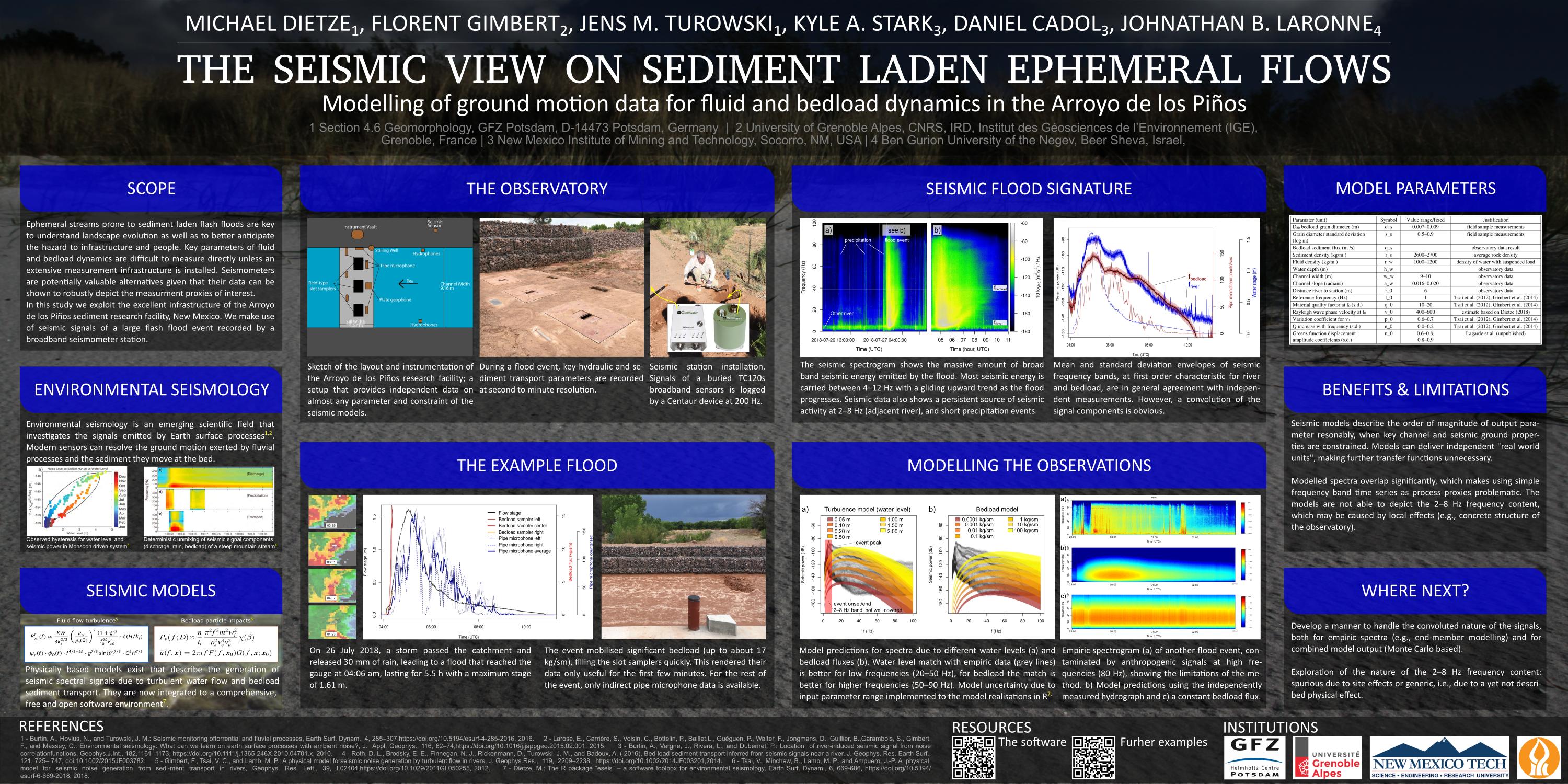
Modern seismometers are sensitive enough to measure not only signals of earthquakes but also signals of environmenal sources, such as landslides, rock avalanches, bedload transport in rivers and debris flows. Each process generates a distinct seismic signature in terms of evolution, amplitude and duration of the seismic waveform but also in terms of its spectral properties. With a network of distributed seismic sensors it is possible to locate the process due to the different travel times of a seismic wave from the source to the sensors. Thus, environmental seismology allows detection, identification, location and detailed description of a rich spectrum of Earth surface processes. This only recently emerged discipline field still is a mainly undiscovered field and its potential may only be estimated based on the few glimpses of possibilities as reveald by the current studies.
My current research projects revolve around the seismic signals of mass wasting and river sediment transport processes and their rapid detection across different landscapes.
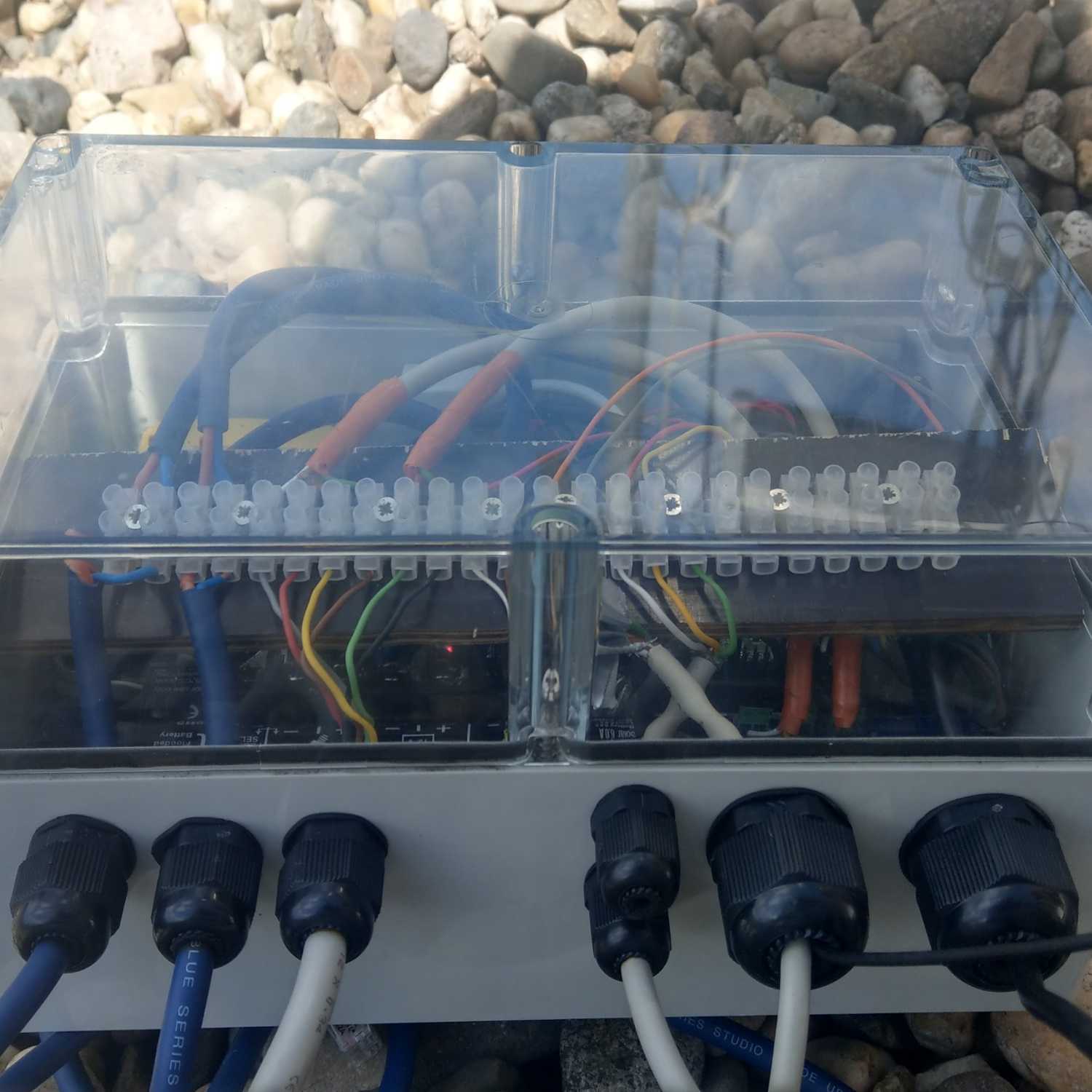
I am currently building a Low cost telemetric seismic and environmental sensor station, which can be used for broad purpose environmental research. The goal is to design and build a station in the most open way, making available the "shopping list", the assembling details and the software/code to drive the system.
In the Hiddensee Project we utilise a telemetric seismic antenna and weather station to get the current activity and boundary conditions on the island of Hiddensee, northestern Germany, which is a highly active cliff with a series of different modes of failures. The website provides near real time plots of the system (if not currently down).
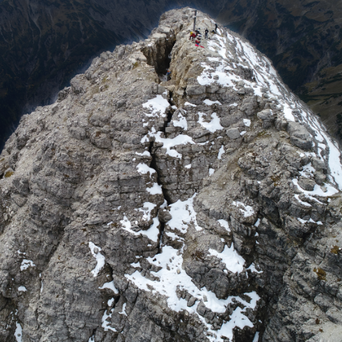
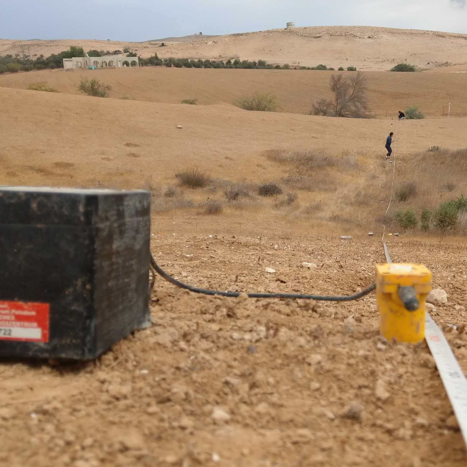
In the Hochvogel Project we utilise a telemetric seismic antenna and a distributed seismic network to survey rock property changes and resulting mass wasting activity on one of the most actively developing rockslides in Germany: evidenced by a 100 m long fracture straight through a mountain peak.
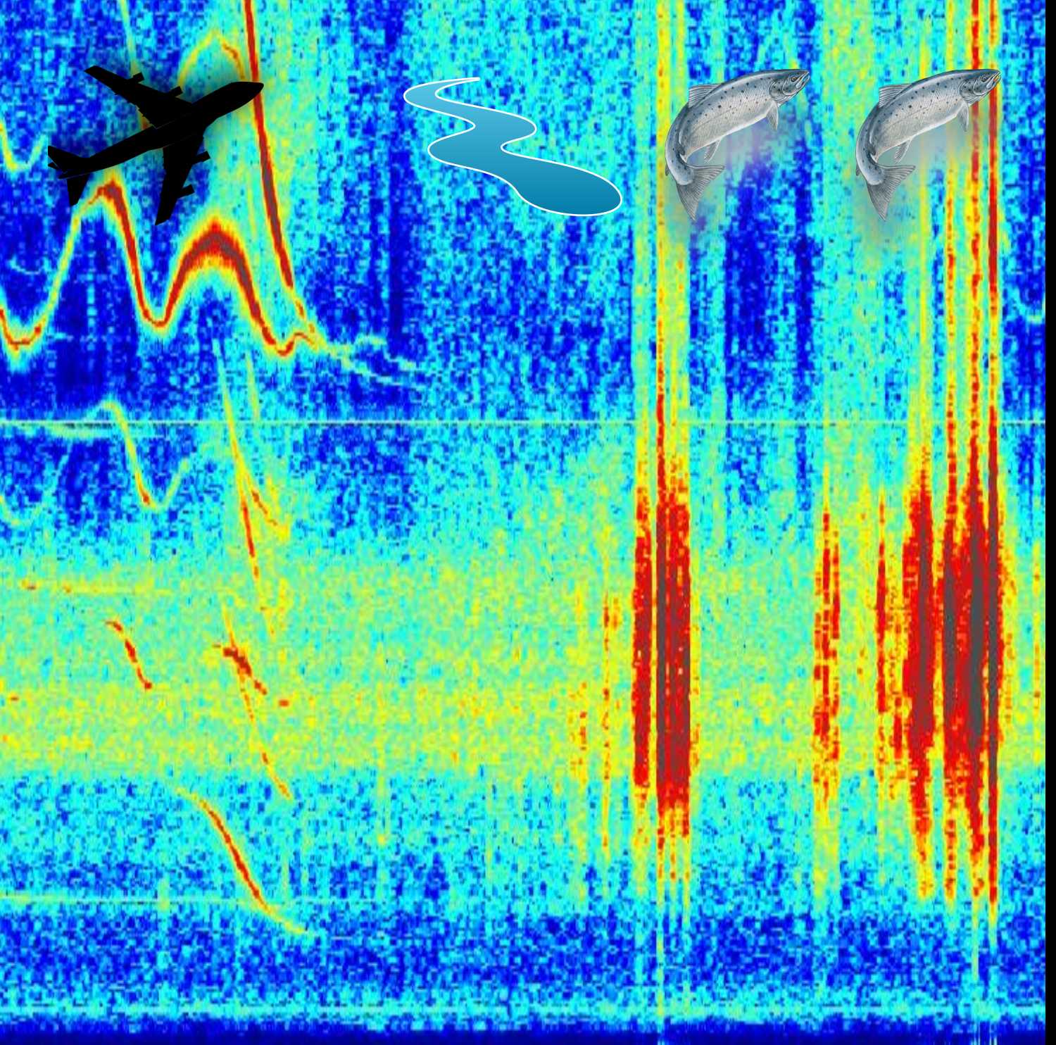
In the Salmon Spawning Seismology project we seismically survey the nest building activity of salmonids in a North American river. These species move bed material around and the seismic data can give precise and detailed insight to this activity.
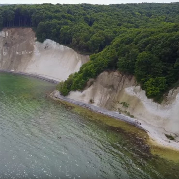
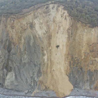
On the cliff coast of Rügen (northern Germany) We have investigated location, timing and boundary conditions of cliff failure events. The observatory is now in its fourth year of deployment with two extreme meteorologic years and loads of results.
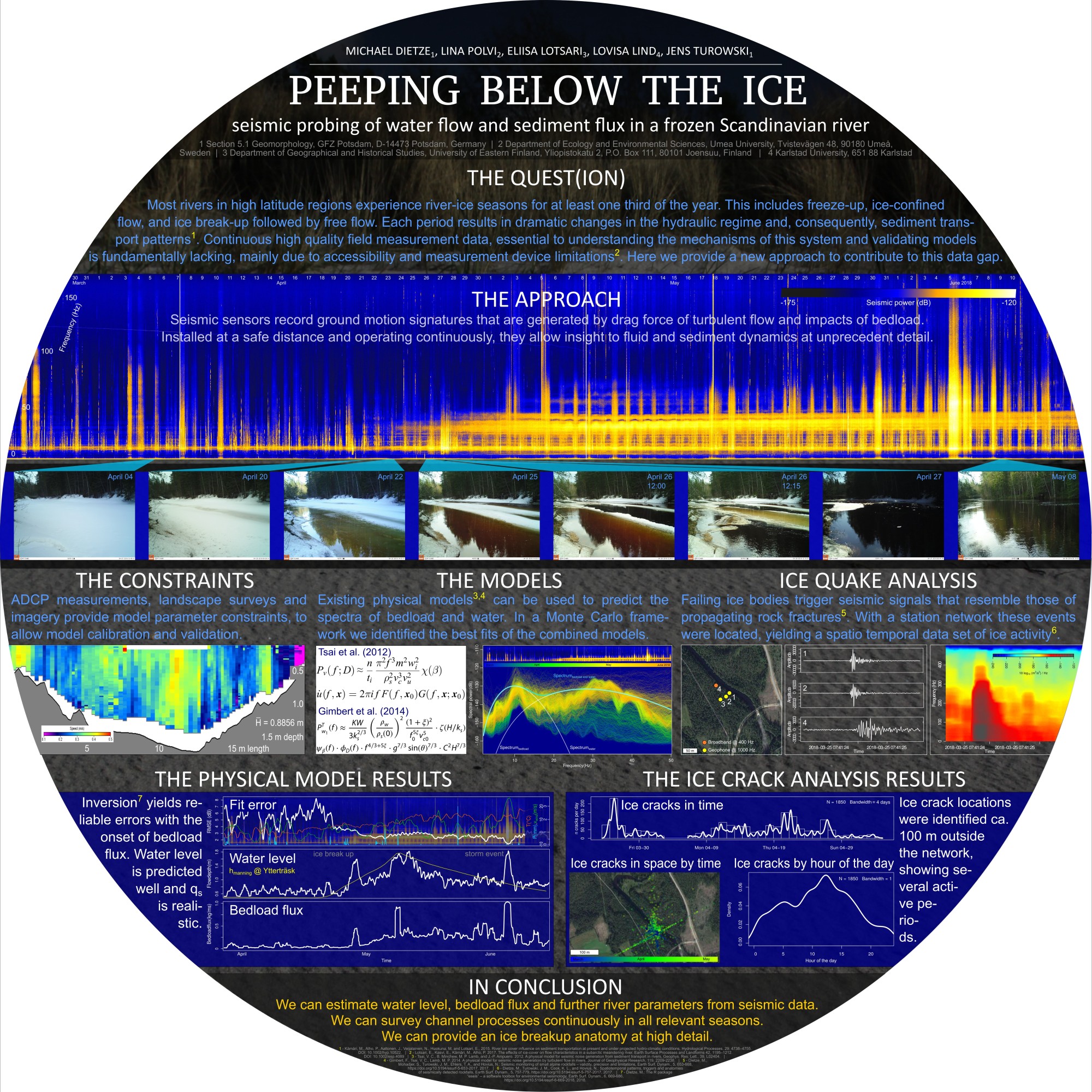
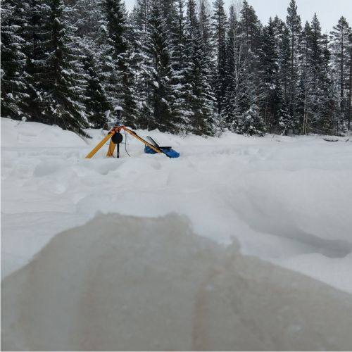
In northern Sweden, in the Icy River Project (near Umea) we have studied the seismic signals of flowing water and mobile sediment under a thick ice cover to provide information on these two important parameters where other methods can hardly be applied.
From the method development realm, in the Fluvial unmixing project we have developed a generic Monte-Carlo based approach to unmixing the seismic signatures of turbulent water flow and bedload particle transport, in order to generate seismically based, empirical time series of water level and bedload flux.
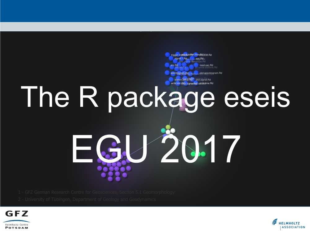
Environmental seismology is based on a massive amount of ground vibration measurements. A single seismic station generates two million samples per hour. Over the decades, seismologists have developed complex, high performance methods to analyise these signals; a pool of tools environmental seismology deliberately benefits from. In order to provide a straightforward tool box to process seismic data, tailored to the investigation of Earth surface dynamics, dedicated to free and open software, and suporting to pass the results to further environmental analysis, the R package eseis has been developed (Dietze, 2018). See eseis website for details.
PRESENTATIONS