The Rügen-Jasmund seismic observatory
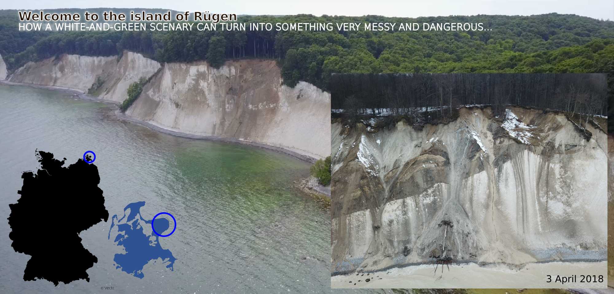
Cliff coasts appear stable interfaces between the land we live on and the sea that hits it continuously. However, cliff coasts are highly dynamics landscape elements. They can fail catastrophically, yet the "Where?", "When?" and "Why?" is hard to constrain with classic approaches. In this project, the cliff coast section of Germany's largest island, Rügen, has been instrumented by a set of seismic sensors and a weather station, from March 2017 to March 2018. The data collection phase is now over and the analysis will start.
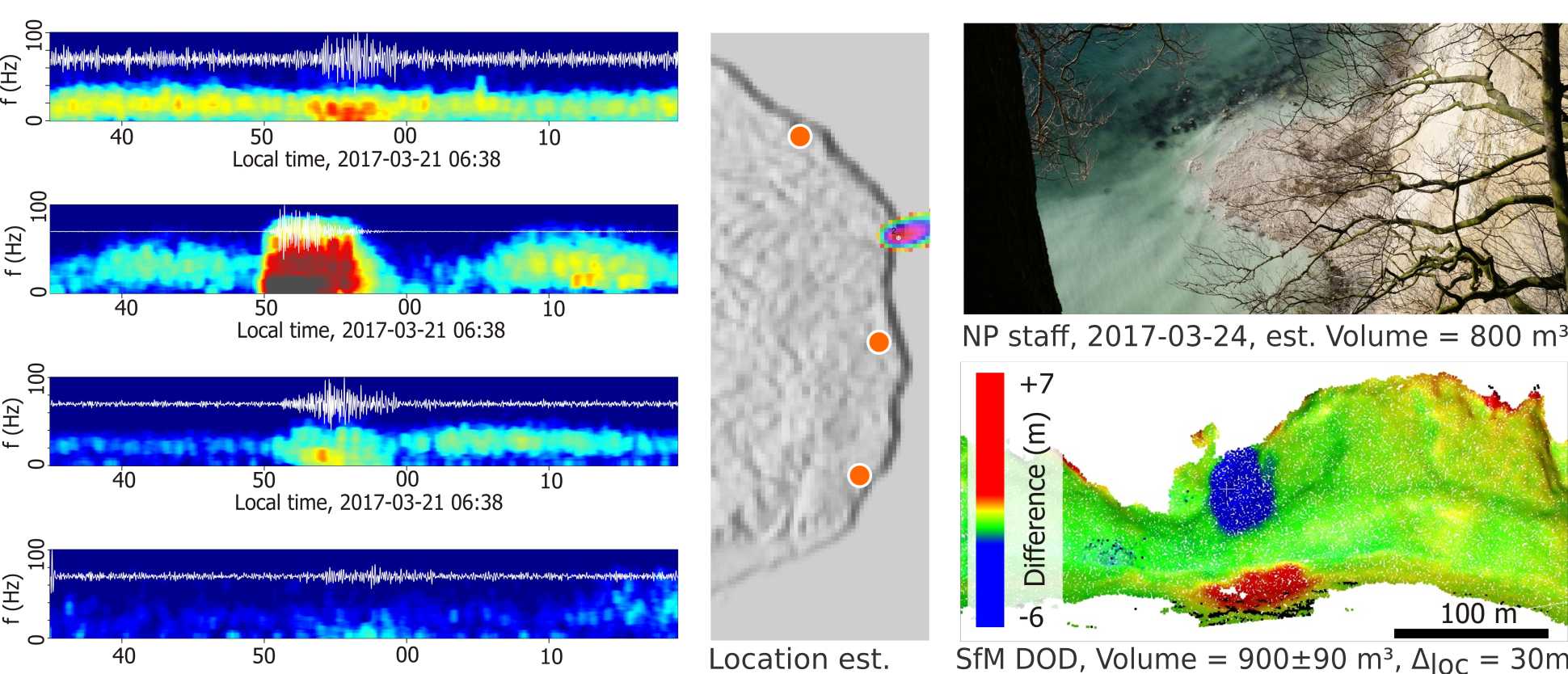
The plots below show the spectrograms of four seismic station that have recorded a cliff collapse. The time delay with which the seismic wave, emitted by the collapsing mass, arrives at each station (offset of the red colours along the x-axis) allows locating the source and its occurrence time. The lower right panel shows a 3D model of the detached mass (blue colours) and its deposit at the beach (red colours).
In total, about 50 of such events were detected during the one year instrumentation time. The current analysis is focused on examining the failure processes of each event in detail, link it to potential trigger processes (breaker waves, heavy rain, freeze-thaw transitions, and so on).