The Brienz/Brinzauls (Grisons, CH) rockslide
A 10–20 Million cubic metre large slope instability sits above an Alpine Village in Grisons, Switzerland. Despite the pitoresque scenery of Brizauls (or Brienz, though not the city of Brienz near Interlaken) there is a complex geomorphic crisis looming. While being on the move for thousands of years, the entire slope has started accelerating throughout the last 15 years. The situation is a complex one. There are actually two slope instabilities: a relatively slow moving one (Rutschung Dorf) on which the village of Brinzauls is sitting, and which is sliding down slope by a few metres per year (or several mm per day), and a much more active one (Rutschung Berg) just above the village, which has been moving at a comparable pace as the Rutschung Drof but that started accelerating some 15 years ago to 5–10 m per year (several cm per day). One part of Rutschung Berg, the "Insel", an about 2 Mio cubic metre large chunk, is currently accelerating exponentially, reaching values of more than 40 m per year (some decimetres per day). It is not (only) the gradual sliding process that causes problems, rather it is the rapid and unpredictable mass wasting processes that are triggered by that movement – rockfalls, block falls and rock avalanches – that pose the immediate threat to the village and the roads connecting it to the rest of Switzerland. The annotated photo below depicts that situation as seen from the former school building at the western entrance to the village.
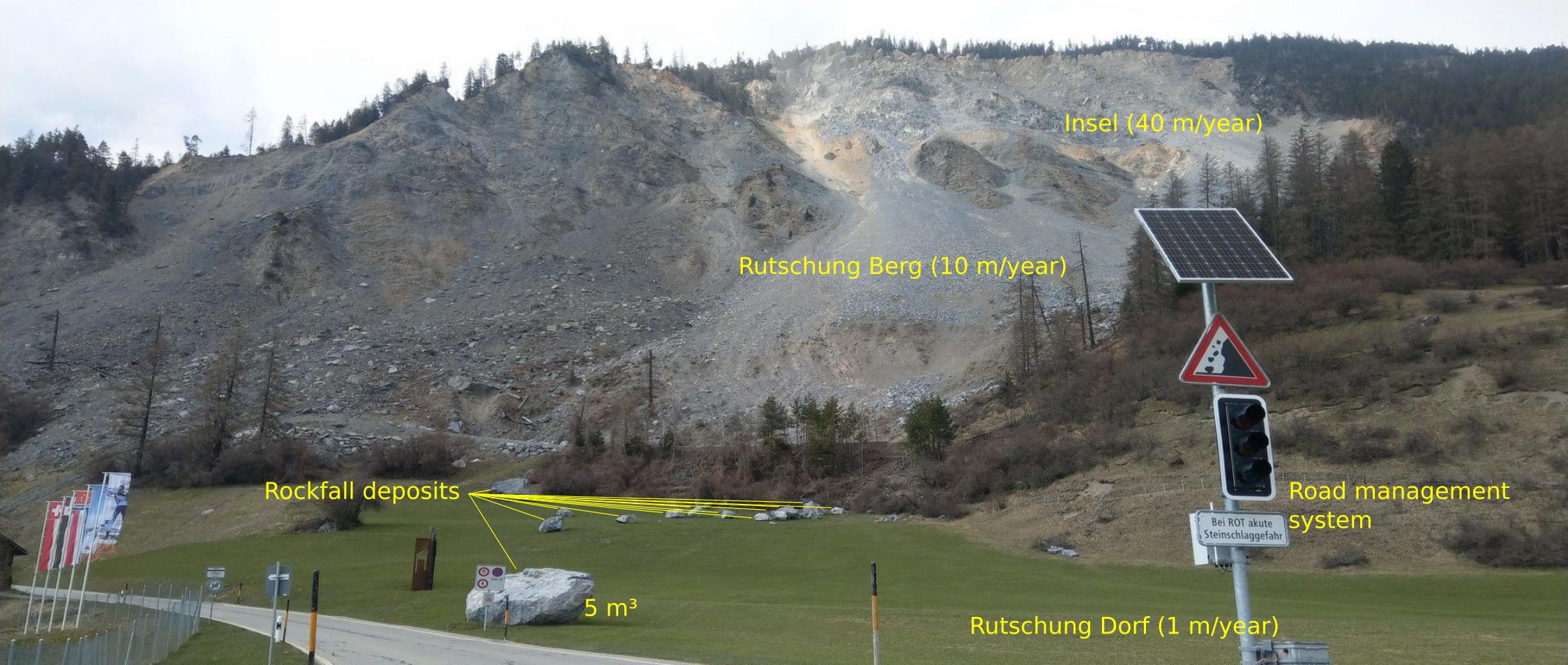
In this project, we focus on those hard to predict yet rapid processes that send rocks, blocks and avalanches of debris towards the village, with velocities up to 50–70 km/h. In 2019, we have deployed a network of now up to eight seismic stations (including geophones and broadband sensors) that allow to detect, locate, track and quantify slope activity continuously over time at sub second precision. This growing catalogue of events allows us to study the surface expression of large scale deformation processes and tie that driving force to actual triggers of hazardous rapid mass wasting events. We complement the seismic system with periodic high resolution UAV and TLS surveys to validate the geophysical approach and increase the spatial precision of the catalogue.
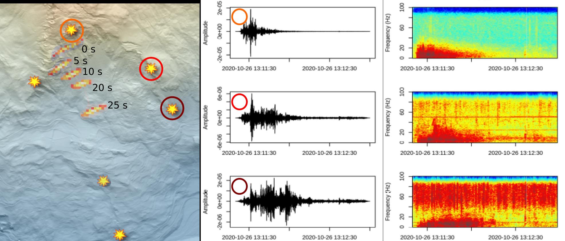
The above panel shows the instable landscape in 2020, where the Rutschung Berg in the North is surrounded by four seismic stations and two stations are located on the Rutschung Dorf. The seismograms (middle panel) and spectrograms (right panel) of one small rockfall event are shown as recorded by the three eastern seismometers. Note how different the three seismograms look beause the rockfall is propagating along slope (orange polygons on map with time stamps), thereby emitting different amounts of energy and changing its distance to each sensor. However, a new tracking technique (cf. Cook et al., 2021) allows to account for that and deliver a robust trajectory of the mobile mass.
In the light of exponentially increasing activity of the Rutschung Berg, we have now improved the seismic network and are currently analysing the evolution of event activity and spatio-temporal patterns of the recent slope failures in detail.